
After five years of a complex and lengthy process, the Papua Provincial Government finally established Kolepom Island Marine Protected Area (MPA) on September 26, 2020. Kolepom Island, also well-known as Dolok Island, is part of Merauke Regency, leaf-shapes, and separated only by the narrow Muli Strait from the mainland of Papua.
The Governor of Papua Lukas Enembe signed a Governor Decree No.188.4/295/2019 to secure an area of 353, 286 Ha in Kolepom Island, Merauke District, Indonesia, as an MPA. The MPA is designed to achieve sustainable management of key marine species and preserve the rare and protected sawfish species (Anoxypristis cuspidata, Pristis clavate, and Pristis pristis).
Read also: Kolepom Island Officially A Marine Protected Area
The Indonesian government welcomed this new MPA because the Ministry of Marine Affairs and Fisheries (MMAF) targets to establish a total of 30 million hectares of MPAs by 2030. However, establishing a new MPA is only the first step towards protecting and ensuring sustainable marine resources management. The next big challenge is ensuring the operational and effective management of MPAs so benefit the community. Creating an operational MPA management body and the development of a Management and Zoning Plan are two important steps towards effective MPA management.
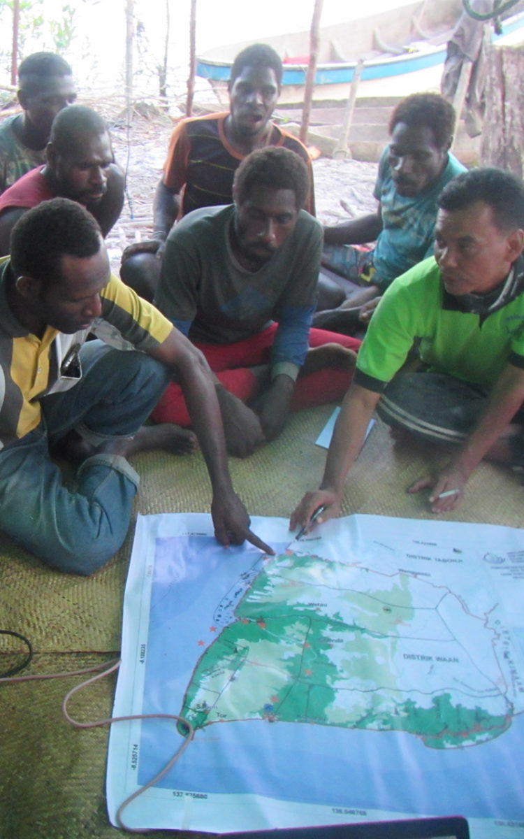
On December 30, 2020, Secretary of the Papua Province, Doren Wakerkwa followed up the decree by sign an appointment decree No. 188.4/21536/SET on Task Force Formation for the development of Kolepom Island MPA Zoning Plan. This task force is led by the Marine and Fisheries Office of Papua and supported by relevant national and provincial agencies, local universities, community leaders’ representatives from 3 (three) districts (Kimaam, Waan, and Tabonji), and ATSEA-2 Project. The Task Force will collect, compile, and analyse data and information, design zones and sub-zones, and do public consultations to garner inputs from wider stakeholders.

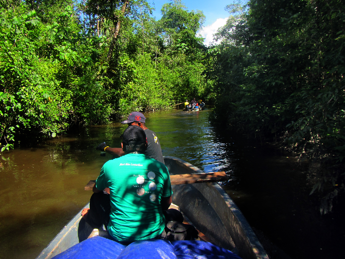
Coastal and Marine Management Center (LPSPL) – Sorong team passing through Kocember River to reach Yeraha Village, Tabonji District, Merauke, Indonesia. Photo by: LPSPL Sorong 
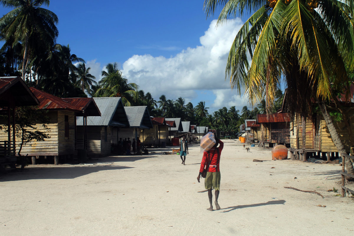
View of Yeraha Village, Tabonji District, Merauke, Indonesia Photo by: LPSPL Sorong
Several activities have been carried out toward developing the MPA zoning plan, including coordination meetings among the task force members, technical capacity building, consent on the roadmap, and Focus Group Discussion (FGD) with key stakeholders. Moreover, as part of the Task Force, the ATSEA-2 team contributed technical support during the capacity building, provided technical assistance for zoning design, and facilitated meetings.
Zoning plan is a vital precursor for effective MPA management and effectively managed MPAs are widely recognized to lead to positive outcomes for biodiversity and fisheries sustainability. Conserving Kolepom Island off Papua’s coast is crucial to initiate protection and sustainable management for this high-value area. As a part of the Arafura and Timor Seas region, Kolepom Island’s abundant and pristine mangrove cover and river mouths bring fatty nutrient deposits, contributing to its high productivity. These conditions make the coast of Kolepom Island a thriving nursery ground for fish and shrimps, which attracts many fishers.
The soon-to-be-developed MPA Management and Zoning Plan will be useful, not only for Kolepom Island but also for Papua Province on a larger scale. As the zoning plan will provide the foundation for Kolepom Island MPA management, it will also feed to the Papua Provincial Marine Spatial Planning (MSP), which is now in an on-going development process. Integration of Kolepom Island MPA Zoning Plan to Papua Provincial MSP will ensure high levels of protection for significant areas of the MPA while allowing sustainable use and better ecological connectivity within Papua Province. For the next step, the ATSEA-2 project will support the Task Force to carry out field assessment activities to refine data and key information as a basis for the development of the Kolepom Island MPA Management and zoning Plan.
This article was also published on IW:Learn Website